
Here are the 5 best Fall foliage drives near Crested Butte by TravelCrestedButte.com:
https://travelcrestedbutte.com/5-best-fall-foliage-drives-near-crested-butte

Here are the 5 best Fall foliage drives near Crested Butte by TravelCrestedButte.com:
https://travelcrestedbutte.com/5-best-fall-foliage-drives-near-crested-butte
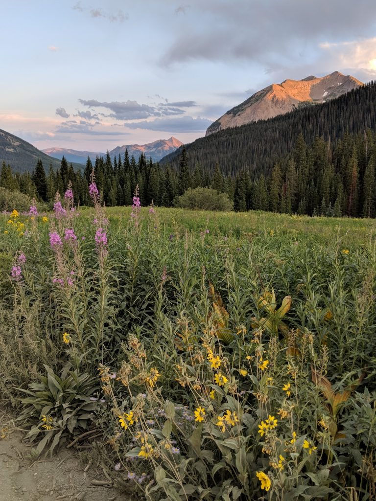
Taking Gothic Road outside of the Town of Crested Butte will lead you up to the ski area or Mt. Crested Butte. From here you’ll continue through Mt. CB to the old town site of Gothic. Gothic has a unique vibe with the Rocky Mountain Biological Institute, which has been established since the late 1920’s, and conducts a slew of scientific studies on the bio-diversity which makes this area special and world famous for the abundancy of wildflowers.

As you pass through Gothic the road becomes more rough, muddy and tight in some places. Go past the Rustler’s Gulch trail, which is another great option, until you reach the snow pile. There is an area just before Emerald lake where two avalanche paths meet and usually piles up with snow and debris. Due to having a big snow year last season, this area is still not safe to pass on top of with a Jeep. Therefore we recommend parking the vehicle and walking the less then a mile to the lake.
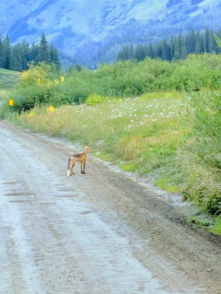
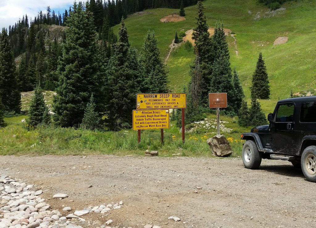
Schofield Pass sits within the Sawatch Range of the Elk Mountains between Crested Butte and Aspen. The pass tops out at an elevation of 10,707 between the town sites of Gothic and Marble. Once the snow melts, many of our renters travel what we call the big loop which encompasses Slate River Road, Paradise Divide, Paradise Basin, Schofield Pass and ending with the town site of Gothic before heading back to Crested Butte. Timing wise this usually puts you back in town for a late lunch or to re-supply before heading back out for more off-road adventures.
Schofield Pass continues beyond the point imaged in the photo, where a large sign warns drivers of the ensuing danger of The Devil’s Punchbowl. For safety purposes our vehicles do Not go beyond this point.
This area is world renowned for its wildflowers and there is a reason why we have an entire festival dedicated to the flowers. If you’ve ever dreamed of being surrounded by wildflowers in a high alpine meadow, like in the movie ‘Sound of Music,’ then this is your spot! Hikers have many options to choose from as well, if it’s the infamous 401 trail, hiking to Judd Falls, the 403 trail, Rustlers Gulch, Deer Creek, Copper Trail, the many offerings in the Snodgrass area or even the West Maroon Creek Trail to Aspen.
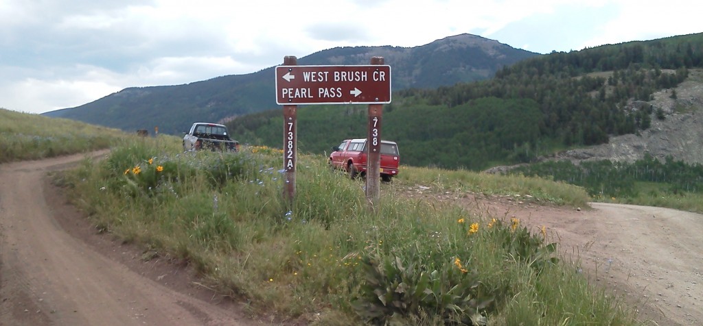 One of the more quiet and peaceful adventures in our zone, the West Brush Creek and Pearl Pass Roads trails provide hours of quality Jeeping. Starting only a few miles out of the Town of Crested Butte, Colorado the pavement ends at the private airport and neighborhood Buckhorn Ranch. Motoring on the dirt road, it is important to keep an eye out for bicyclists, cows and nice old friendly ranchers and their wiry dogs. A few miles back you come to a sign and turn-off as shown on the photo. West Brush Creek Road is to the left. Start here and take the next left about a mile past these signs for a dead-end scenic overlook. This is a great spot to walk out to the ridge and take a few photos. The gate keeps vehicles from continuing into the wilderness area. So turn around and continue North or left on the West Brush Creek Road. It is recommended to turn on the 4WD in the high setting until you reach the flats towards the end of the trip. This will aid you as you cross the creek and gain in elevation and other hazards. There is a large mud hole towards the top 1/3 of the trail. I tell people to take it on the left and stay out of the large potholes. Once you come to the end of the road, stop and let the vehicle cool down and don’t forget to smell the roses! This trail provides access to an amazingly beautiful overlook underneath the Teocalli Mountain, so get out and take some photos.
After a break, turn around back to the turn off in the photo. Take a left onto Pearl Pass Road and go slow as soon you will be on an overhang with no room to turn around. This section mandates concentration, focus and a cool head. Luckily it doesn’t last long and after a deep (at times) creek crossing you’re cruising again. This section is a scenic stretch of beaver ponds, fishing holes and world class single-track trails.
To keep our customers and Jeeps safe, we allow customers up until the third creek crossing. This keeps it simple, the first two creeks are ok to cross if the water levels are low and you have our permission at the time of pickup. This way we all have the current trail conditions to help make better decisions and route finding. In no way are our Jeeps to attempt to cross the third creek!
All of our renters are given a map, detailed instructions and current trail conditions to best serve our customers and keep everyone safe.
